
Weather
Weather news from McAllen and the Rio Grande Valley.

 Weather
Textbook summer weather and more tropical dust on the way
HARLINGEN, Texas (ValleyCentral) — Students heading back to school Friday morning will be greeted by warm temperatures and clear skies, with readings expected to range from 80 to 83 degrees across the Valley. Conditions will remain quiet early, but southeast winds will gradually strengthen through the day, creating breezy conditions by the afternoon. A developing
 Weather
Valley Storm Team: Preparing for the busiest part of hurricane season
HARLINGEN, Texas (ValleyCentral) — In this edition of Valley Storm Team, forecasters Craig Verley and Taylor Gomez take the latest look at what we can expect over the next few days. But before they look forward, they explain current conditions and how the lack of rain over the last few weeks is impacting drought conditions
 Weather
Hot and breezy trend continues into the weekend
HARLINGEN, Texas (ValleyCentral) — Another hot day is in store for the Valley today. Temperatures will quickly start to warm up, with highs ranging from the upper 80s to the lower triple digits. The heat risk will range from a moderate level to an extreme level today, so make sure to stay cool and hydrated
 Weather
Weslaco Explores Stormwater Reuse to Strengthen Future Water Supply
Weslaco is investigating stormwater reuse as a means to enhance its water supply for agriculture, industry, and municipal needs. Mayor Adrian Gonzalez highlighted the city's efforts to convert stormwater from a flooding issue into a valuable resource. The city currently has facilities capable of storing about 288.7 million gallons of water. Collaborating with Hidalgo County and regional partners, Weslaco aims to retain stormwater instead of allowing it to flow away. This initiative is part of a broader strategy to ensure reliable water supplies for future economic growth and to improve flood management while supporting infrastructure development.
 Weather
Tropical Storm Lala Forms in the Pacific, Puts Hawaii on Alert
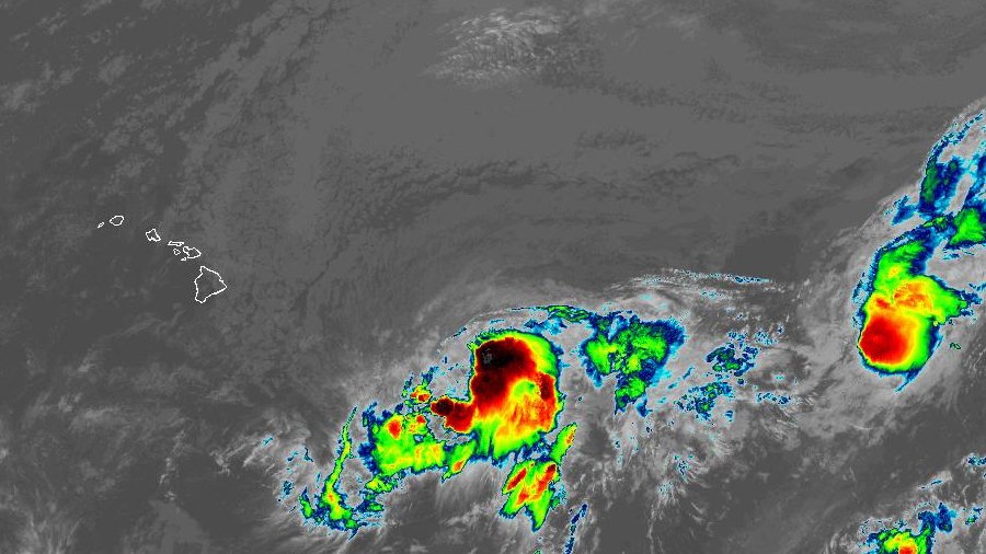
Tropical Storm Lala formed on Thursday in the Pacific Ocean, putting the Hawaiian Islands on alert, according to the National Hurricane Center (NHC). As of the NHC bulletin at 5 a.m. HT, the system was located 705 miles east-southeast of Hilo, Hawaii, and 915 miles east-southeast of Honolulu, Hawaii. It has maximum sustained winds of 40 mph and is moving west at a speed of 10 mph. Current watches and warnings include a hurricane watch in Hawaii County, Hawaii.
 Weather
Magnitude 5.5 Earthquake Strikes Off the Coast of El Salvador, Felt in Honduras and Nicaragua
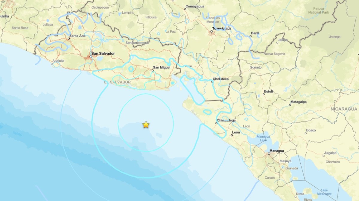
A magnitude 5.7 earthquake struck off the coast of Usulután, El Salvador, on Tuesday, with tremors felt in Honduras and Nicaragua. No casualties or material damage have been reported in any of the three countries. The U.S. Geological Survey (USGS) located the epicenter approximately 69 kilometers south-southwest of Chirilagua. El Salvador's Ministry of Environment confirmed the earthquake's details and reported that emergency services, including firefighters, conducted inspections in affected areas, finding no structural damage. Authorities in Honduras and Nicaragua also reassured the public that there was no tsunami threat and urged residents to stay calm and informed through official channels.
 Weather
Solar Eclipse, Six-Planet Parade and Perseids Converge on Aug. 12
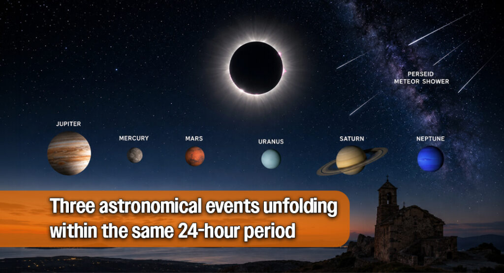
On August 12, 2026, skywatchers will witness a rare convergence of astronomical events, including a total solar eclipse, a six-planet parade, and the Perseid meteor shower. Before dawn, Jupiter, Mercury, Mars, Uranus, Saturn, and Neptune will align in the morning sky, with some visible without telescopes. Later that day, a total solar eclipse will occur, although the path of totality will not cross Texas. The eclipse will be visible in parts of Europe, with totality lasting under two and a half minutes in select areas. The night will conclude with the Perseid meteor shower peaking, offering ideal viewing conditions due to the new moon phase.
 Weather
Plenty of sunshine and a parade of planets
HARLINGEN, Texas (ValleyCentral) — If you love a parade and don't mind getting out of bed a little extra early Thursday morning, we have just the event for you. Go to an area away from city lights for better viewing an hour or so before sunrise. Then look towards the north, fairly low on the
 Weather
Tropical Storm Cristobal forms in the Atlantic
Tropical-storm-force winds extend out about 90 miles from its center.
 Weather
Look to the Sky Tonight: The Perseid Meteor Shower Reaches Its Peak
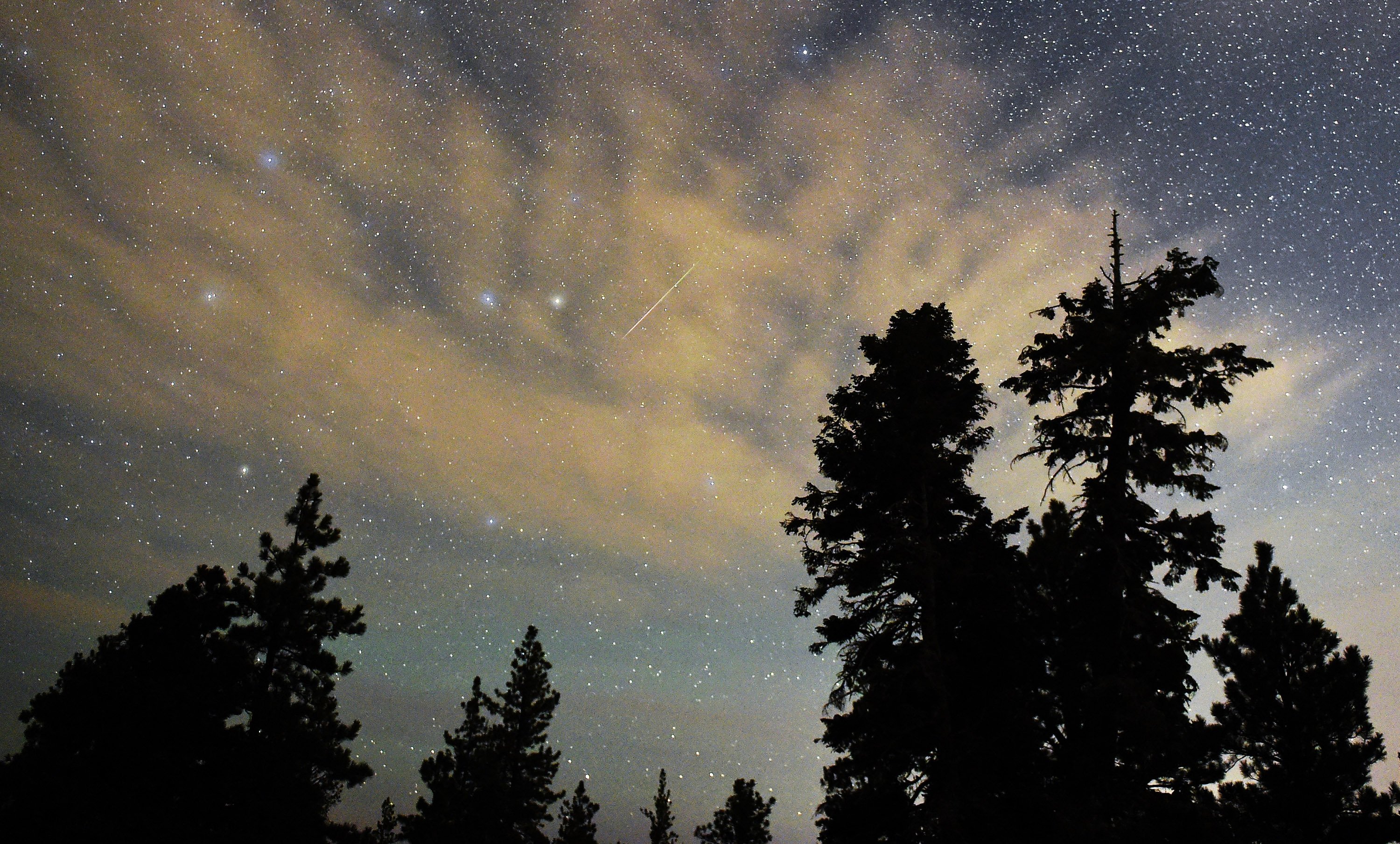
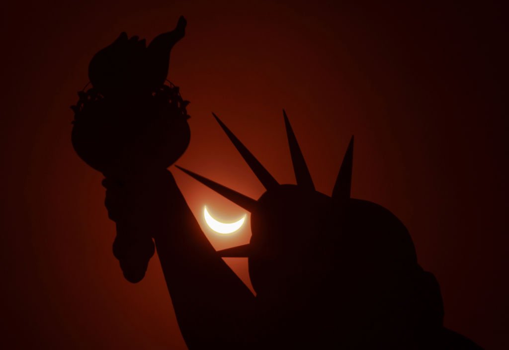
One of the brightest and most popular meteor showers of the year peaks this week, providing an opportunity to see shooting stars streak across a particularly dark sky thanks to the new moon. The Perseid meteor shower has been active since mid-July, but it is expected to reach its peak during the night from Wednesday to Thursday. As the illuminated side of the Moon is currently facing the Sun and its night side looks toward Earth, moonlight will not interfere with one of the most anticipated skywatching events of the summer. Fortunately, the peak of the Perseids coincides with what may be the most awaited celestial event of the season: a total solar eclipse that will be visible from Spain, a small part of Portugal, Greenland, Iceland, and northern Russia on Wednesday.
 Weather
The solar eclipse crosses the sky this Wednesday: Where can you see it in the U.S.?
A solar eclipse will occur this Wednesday, with total visibility in parts of Spain and Iceland, while the U.S. will see a partial eclipse. The path of totality will start near the North Pole and move south through Greenland, Iceland, Spain, and Portugal. In the U.S., cities like Bangor, Portland, Boston, New York, Philadelphia, and Washington, D.C. will experience varying degrees of coverage, with the maximum in Bangor at 24%. NASA will stream the event live starting at 1:15 p.m. ET. The next total solar eclipse in the U.S. will be in August 2044.
 Weather
Tropical Storm Cristóbal Forms in the Atlantic; Expected to Move Away from the U.S.
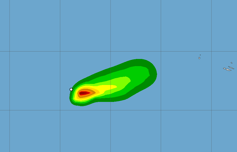
Tropical Storm Cristóbal formed in the Atlantic on Wednesday but currently poses no threat to coastal areas, according to the National Hurricane Center (NHC). As of the latest report at 11 a.m. ET, the storm was located 880 miles west of the Azores, moving east at 25 mph with maximum sustained winds of 45 mph. There are no watches or warnings in effect. The NHC forecasts that Cristóbal will dissipate by Thursday, continuing its path over open waters away from the U.S. coastline.
 Weather
Heat cranks up, chance for showers on Friday
HARLINGEN, Texas (ValleyCentral) — A strong high‑pressure system has been parked over the the region like it owns the place, cranking up temperatures and pushing pollution down toward the surface. That sinking air mechanism is why our air quality has dipped into the “moderate” zone, and it’s planning to hang around through Wednesday. By Friday,
 Weather
Back-to-school season begins with hot and muggy weather
HARLINGEN, Texas (ValleyCentral) — It might be back to school season but Mother Nature is still giving us hot, humid and sunny weather across the Valley. A high-pressure system that is centered over the state of Louisiana enforces a little to no rain weather pattern, high temperatures above normal, mild and muggy mornings along with
 Weather
Extreme summer heat causing severe vehicle damage, Edinburg mechanic warns
Extreme summer temperatures in the Rio Grande Valley are causing significant vehicle issues, warns Edinburg mechanic Joangel Velasquez. He experienced problems with his 2016 Chevy Malibu, including overheating and air conditioning failures. Joe Garcia, owner of Joe's Master Service Center, advises drivers to check their vehicles regularly, as heat can lead to battery failures and tire issues. He estimates that 35% of vehicles brought to his shop this year were already in poor condition. Garcia recommends visiting a mechanic for a thorough inspection during oil changes to prevent breakdowns. Velasquez emphasizes the importance of vehicle maintenance despite rising costs.
 Weather
Weslaco Expands Flood Control Network Through Retention Facilities
Weslaco is enhancing its flood control measures by expanding its network of retention and detention facilities, according to Mayor Adrian Gonzalez. The city is investing in engineered structures, known as RDFs, to capture stormwater before it impacts homes. A key project involves converting Pablo Peña Park into a dual-purpose facility that serves as a park and flood protection. Since 2018, Weslaco has completed seven major detention projects, increasing stormwater storage capacity significantly. The mayor noted that flooding incidents have decreased from 2,500 homes affected in 2018 to just a few in recent storms, emphasizing the importance of regional cooperation in flood management.
 Weather
Monitoring Tropical Waves with Development Potential in the Atlantic
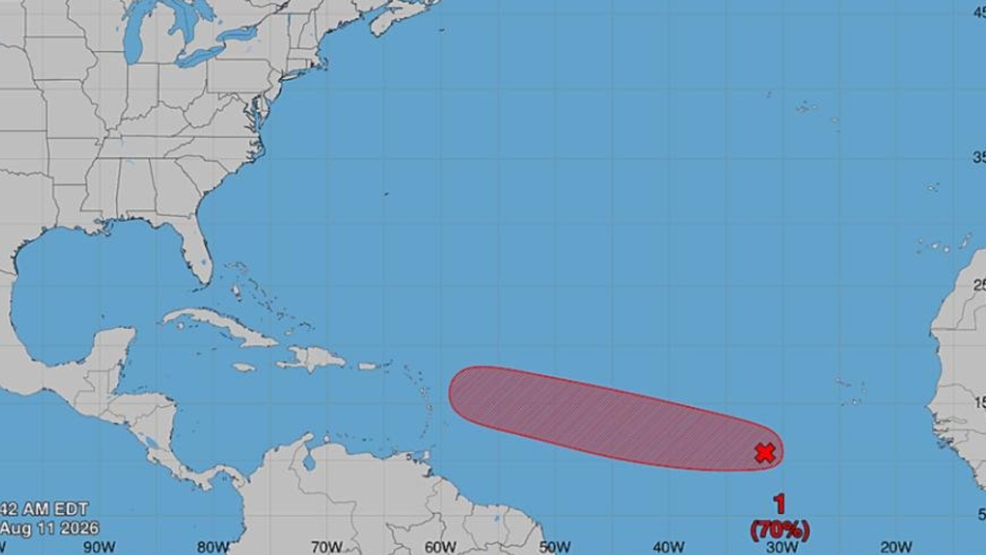
PUERTO RICO – The National Weather Service (NWS) reported that they are monitoring a system with a 70% chance of development over the next seven days. The system is expected to become a tropical depression by the end of this week and move westward in the Atlantic. Meteorologist Zamira Mendoza previously indicated that it could pass northeast of Puerto Rico between August 15 and 17. 'This wave is anticipated to be over the waters of the Atlantic by tomorrow, Tuesday, and we could have a tropical depression or a tropical storm by the end of this week,' she explained. The NWS communicated that it is too early to determine what impacts, if any, it could have on the island.
 Weather
Monitoring Tropical Waves with Development Potential in the Atlantic
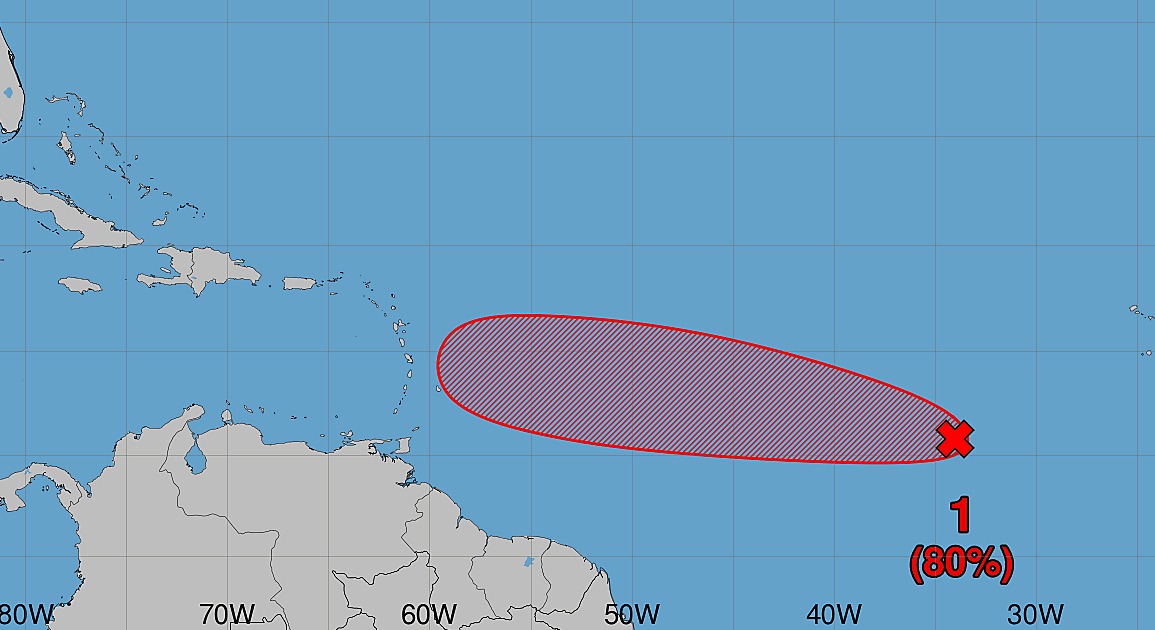
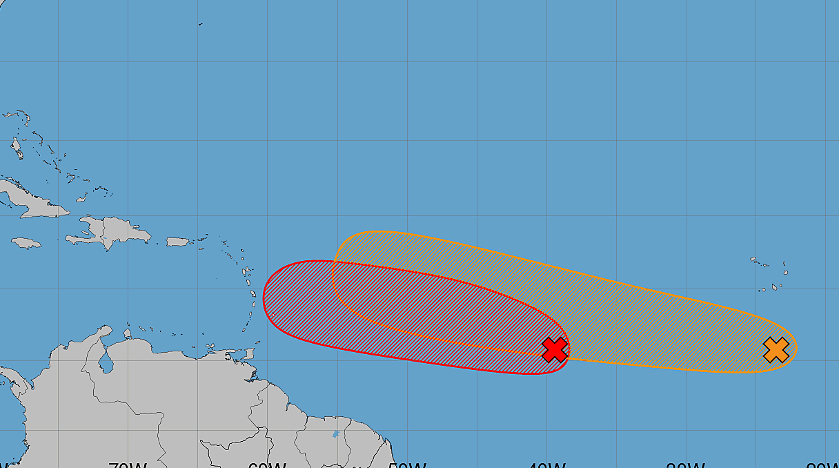
PUERTO RICO – Invest 92L continues to gain organization in the Atlantic and has increased its chances of cyclonic development, becoming a system of interest for Puerto Rico as sectors of the island face drought conditions and rationing. The system, associated with a tropical wave located about 700 miles southwest of the Cape Verde Islands, is showing signs of increased organization with rain and thunderstorms. According to the latest report, the probability of formation has risen to 60% over the next 48 hours and to 80% over the next seven days. If the trend continues, a tropical depression could form in a couple of days as the system moves west and west-northwest through the central tropical Atlantic. Meanwhile, two other systems are under surveillance in the Atlantic basin. Invest 93L, located in the central subtropical Atlantic, maintains a 40% chance of development both in 48 hours and over the next seven days. A short-lived depression or tropical storm could form before the system reaches cooler waters, which would limit its development. Additionally, a tropical wave that just emerged from the western coast of Africa has a formation probability of 10% in 48 hours and 20% over the next seven days as it moves west or west-northwest. Stay tuned to the Weather Authority for updates.
 Weather
Tropical Waves Being Monitored for Development in the Atlantic
PUERTO RICO – Invest 92L continues to gain organization in the Atlantic and has increased its chances of cyclonic development, becoming a system of interest for Puerto Rico as sectors of the island face drought conditions and rationing. The system, associated with a tropical wave located about 950 miles southwest of the Cape Verde Islands, is showing signs of increased organization with rain and thunderstorms. According to the latest report, the probability of formation has risen to 80% over the next 48 hours and 80% over the next seven days. If the trend continues, a tropical depression could form in a couple of days as the system moves west and west-northwest across the central tropical Atlantic. Meanwhile, another system remains under observation in the Atlantic basin. This is a tropical wave located several hundred miles south of the Cape Verde Islands, which has a formation probability of 20% in 48 hours and 40% over the next seven days as it moves west or west-northwest. Stay tuned to the Weather Authority for updates.