
Weather
Weather news from McAllen and the Rio Grande Valley.

 Weather
About 4,000 customers without power in Rio Grande Valley at peak of storm, AEP Texas says
HARLINGEN, Texas (ValleyCentral) — Multiple power outages were reported as heavy rainfall moved across the Rio Grande Valley on Monday. At the peak of the storm, American Electric Power Texas reported that about 4,000 customers lost power. However, AEP Texas Director of Communications Omar Lopez said they had crews on standby and ensured enough resources were ready
 Weather
Gulf Alert: Texas Coast Remains Under Tropical Storm Watch
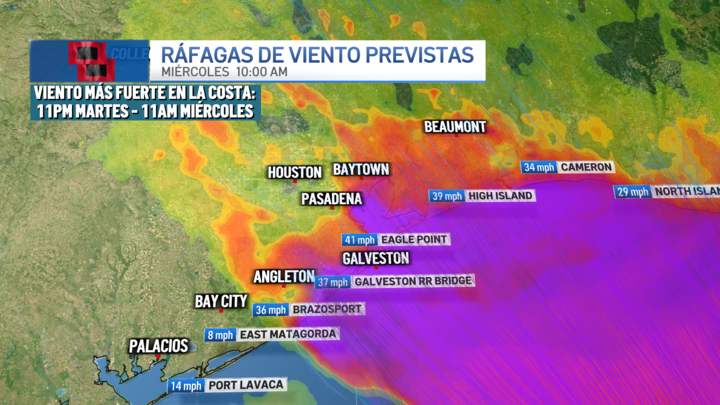
HOUSTON – A tropical storm watch remains in effect for the coastal areas of Brazoria, Galveston, and Chambers counties as a tropical low pressure system moves parallel to the Texas coast and could potentially develop into tropical cyclone Arthur by Wednesday, with minimal impacts expected in this region. The National Hurricane Center (NHC) maintains the projected path of the system near the Texas coast, with expected movement over southeast Texas on Wednesday. 6:30 PM Radar Update: Showers/thunderstorms are tapering off. Expect a lull in precipitation this evening and overnight. Storms are expected to redevelop early tomorrow morning. Remember that flooded areas can stick around even after the rain stops. Turn around don’t drown! pic.twitter.com/JqazoktynE — NWS Houston (@NWSHouston) June 16, 2026 While there is a possibility that it may remain a tropical low pressure or depression in the morning and strengthen later, it is also possible that it may not fully organize. In any scenario, the impacts for our region would be similar. The main effects are expected in coastal areas. Communities under tropical storm watch could experience wind gusts between 30 and 45 mph, while other areas in southeast Texas could see gusts ranging from 25 to 30 mph. Additionally, a storm surge of 1 to 4 feet could lead to coastal flooding. Intense rainfall associated with the system would also increase the risk of urban and flash flooding, especially south of Interstate 10, where locally intense rain bands could develop.
 Weather
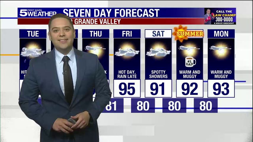
Tuesday, June 16, 2026: Hit-or-miss showers with highs in the 80s
 Weather
Rio Grande Valley included in Gov. Abbott's disaster declaration
HARLINGEN, Texas (ValleyCentral) — Gov. Greg Abbott on Monday issued a disaster declaration for 101 Texas counties, including all four counties in the Rio Grande Valley. Cameron, Hidalgo, Starr, and Willacy were included in the governor's declaration as severe storms swept through the state. "Texas is prepared to respond to the severe weather threats that
 Weather
Governor Issues Disaster Declaration For Texas Severe Weather
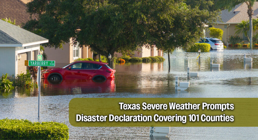
Governor Greg Abbott has declared a disaster for 101 counties in Texas as severe storms pose ongoing threats. He emphasized the state's readiness to respond to these weather challenges and ensure that local officials have access to necessary resources. The Texas Division of Emergency Management has been directed to activate additional emergency response measures and maintain 24-hour operations at the State Emergency Operations Center. Residents are advised to stay informed about weather updates, prepare emergency supplies, and avoid flooded areas. More information on severe weather safety can be found at TexasReady.gov and other state resources.
 Weather
The rain's end is in sight
HARLINGEN, Texas (ValleyCentral) — While our rain chances will be slowly and gradually decreasing as we head through the afternoon, we can still expect to see some scattered showers and thunderstorms, which could include heavy rainfall. That is why the National Weather Service has a flash flood watch for the RGV in effect until 7:00
 Weather
🌩️Interactive Radar for South Texas Area
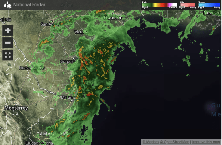
The interactive radar for the South Texas area provides real-time updates on atmospheric conditions. This tool is especially useful for residents of the Rio Grande Valley, allowing them to stay informed about weather changes and potential severe weather events. The radar is accessible for free, ensuring that everyone can monitor the local weather effectively. For continuous updates, viewers can tune in to Telemundo 40's Texas 24/7 news coverage.
 Weather
Gulf Alert: NHC Issues Tropical Storm Watch for Texas Coast
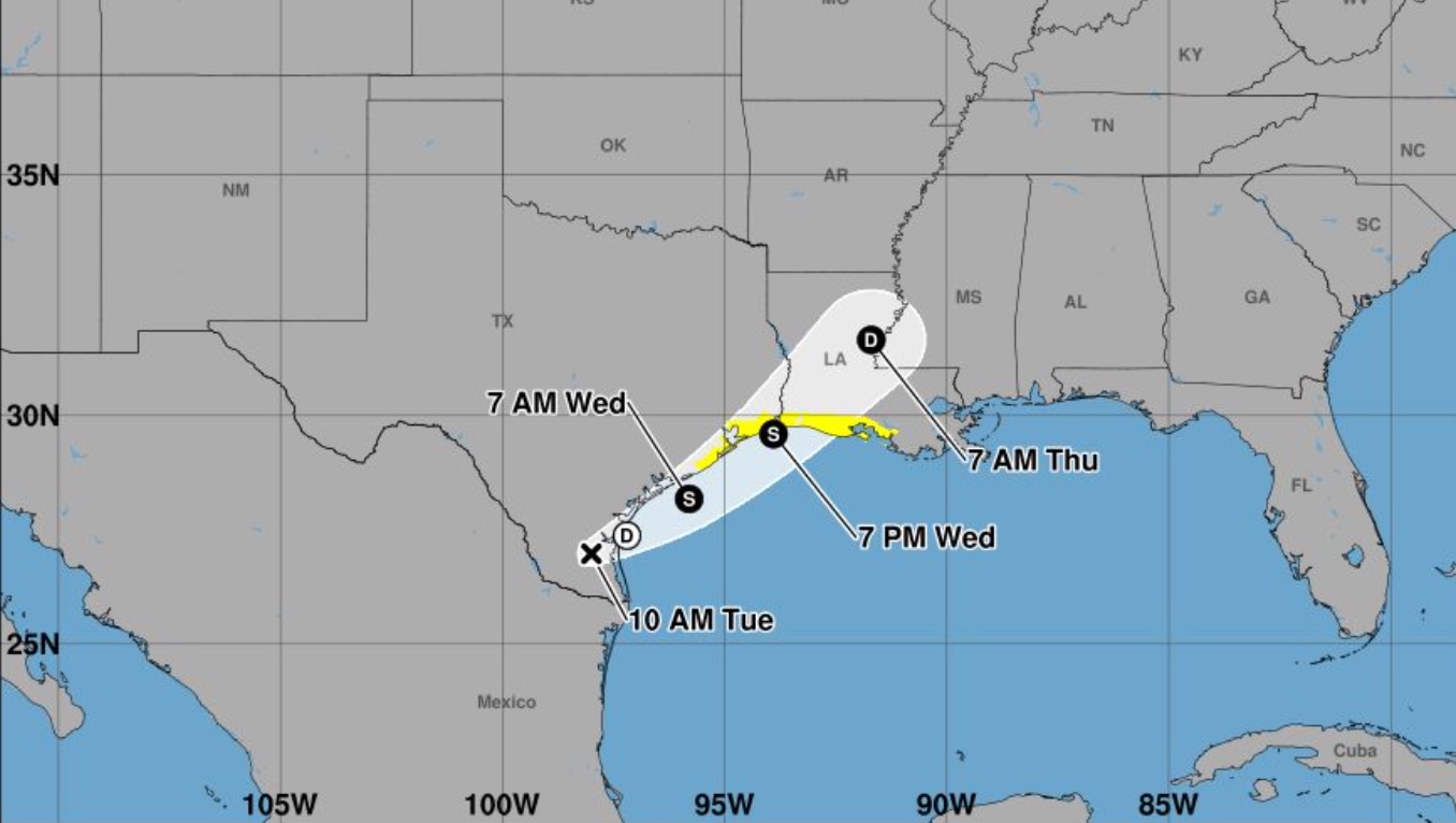
HOUSTON – The National Hurricane Center (NHC) has officially issued the first alert of the season for the Gulf Coast region, which could become the first storm of the Atlantic season. The system, currently referred to as Potential Tropical Cyclone One, threatens to rapidly intensify and make landfall midweek, bringing a severe risk of flooding. Due to the projected path, a Tropical Storm Watch has been issued from Sargent, Texas, to Morgan City, Louisiana. This means tropical storm conditions are possible in the watch area within the next 24 to 36 hours. If it strengthens, the system would be named Tropical Storm Arthur, the first of 2026. What we know about the system: location and trajectory According to the NHC's 10:00 AM CDT bulletin, the disturbance was located as follows: Location: About 65 miles southwest of Corpus Christi, Texas. Maximum sustained winds: 30 mph (45 km/h) with stronger gusts. Current movement: Northeast at 6 mph (9 km/h). Minimum central pressure: 1007 mb. What is the forecast for the system? The disturbance is expected to move offshore from the Texas coast tonight or early Wednesday, advancing parallel to the upper Texas coast (indirectly or directly affecting the Houston/Galveston area). Subsequently, it is anticipated to make landfall again in extreme eastern Texas or southwestern Louisiana between Wednesday night and early Thursday morning. Meteorologists warn that the system has a 60% chance of formation in the next 48 hours, meaning it could officially become a tropical storm by Wednesday.
WeatherGulf Alert: Tropical Storm Watch Issued for Texas Coast
The National Hurricane Center has issued its first Tropical Storm Watch for the Texas Gulf Coast due to a system currently labeled Potential Tropical Cyclone One. Located about 65 miles southwest of Corpus Christi, the system is expected to strengthen and make landfall mid-week, bringing severe flooding risks. The watch extends from Sargent, Texas, to Morgan City, Louisiana, with tropical storm conditions possible within 24 to 36 hours. Rainfall of 4 to 8 inches is anticipated, with isolated areas receiving up to 12 inches, increasing the risk of flash flooding. Residents are urged to prepare and stay informed.
 Weather
Abbott Declares Disaster in Nearly 100 Counties in Texas; Four from the Region
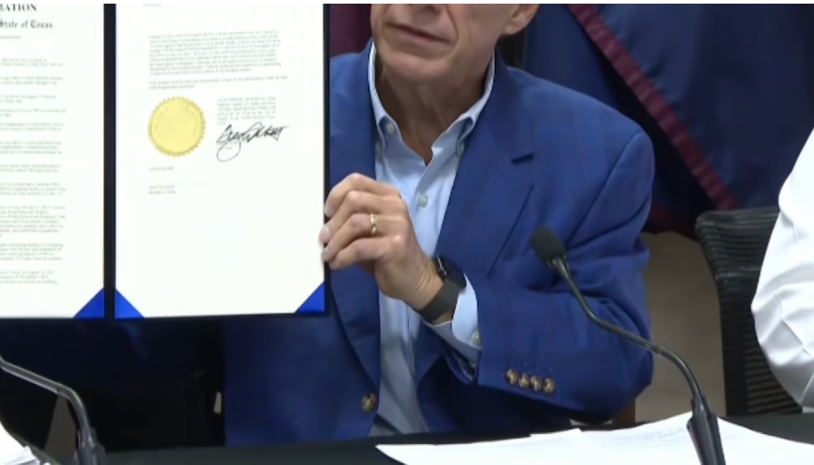
Governor Greg Abbott has declared a disaster in nearly 100 Texas counties, including four in the Rio Grande Valley: Hidalgo, Cameron, Willacy, and Starr. Recent heavy rains have caused flooding, road closures, and evacuations, prompting the establishment of temporary shelters. This declaration enables local officials and communities to access additional state resources to manage the emergency. Abbott noted that the list of affected counties may expand if weather conditions worsen elsewhere in the state. Additionally, he ordered the Texas Division of Emergency Management to activate extra response resources and maintain 24-hour operations at the State Emergency Operations Center as storm threats persist.
 Weather
Section of Frontage Road in Weslaco Remains Closed
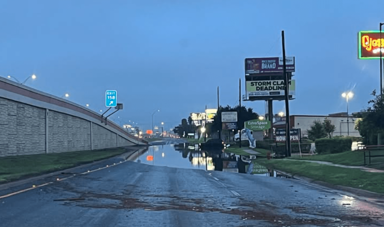
The Frontage Road east of Interstate 2 and Westgate in Weslaco remains closed due to water accumulation from recent heavy rains. According to the latest report from the Texas Department of Transportation (TxDot), water levels are gradually decreasing. However, the road will stay closed while authorities assess safety conditions for reopening. Drivers are advised to use alternate routes and stay updated on the situation.
 Weather
Donna residents grab sandbags ahead of heavy rain in the forecast
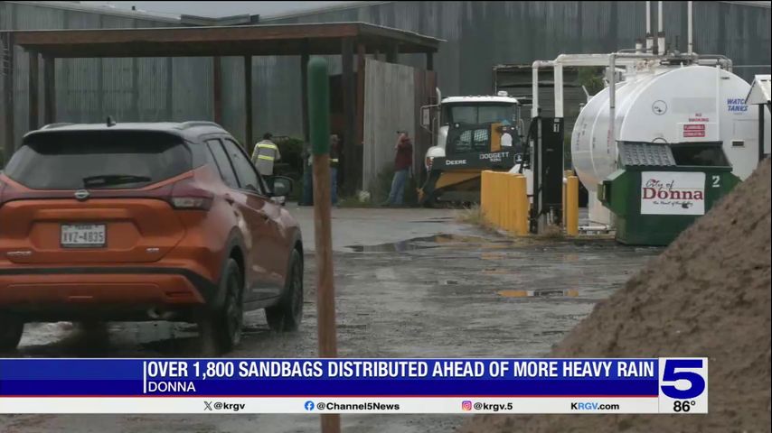
The city of Donna distributed nearly 2,000 sandbags on Monday to help residents prepare for anticipated heavy rain. Mayor David Moreno announced that crews would assist in loading the sandbags, which are produced using a newly acquired machine. Residents must provide proof of residency, such as a utility bill, to receive sandbags. If the initial supply runs out, city officials are prepared to create more. With forecasts predicting an additional three to four inches of rain, the distribution site may reopen on Tuesday if needed. Local resident Carlos Lugo emphasized the importance of being prepared for potential flooding.
 Weather
Over 3, 700 residents without power across the Valley
On Monday evening, 3,733 power outages were reported across the Rio Grande Valley, primarily affecting Hidalgo County, which had 2,444 outages by 11 p.m. Earlier in the evening, the number of outages peaked at 9,213 around 9:30 p.m. These outages coincided with a flash flood warning for Hidalgo and Starr counties, which is scheduled to end at 12:15 a.m. Tuesday. AEP Texas and Magic Valley Electric Cooperative provided the outage data, highlighting the significant impact of the weather conditions on local residents.
 Weather
Prepare for the worst: Weslaco mayor warns residents to evacuate amid flooding risk
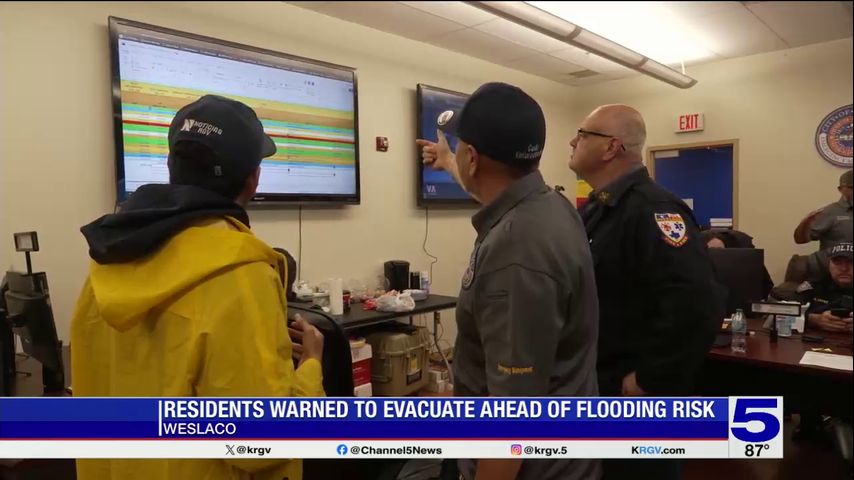
Weslaco city officials are advising residents to evacuate to higher ground due to anticipated heavy rainfall overnight. Those living in flood-prone areas are urged to leave their homes as conditions may deteriorate. Faith-based organizations are offering shelter and transportation for evacuees. Weslaco Fire Chief Antonio Lopez warned that over 10 inches of rain could lead to significant flooding. Texas Governor Greg Abbott has declared a disaster for all four counties in the Rio Grande Valley. Mayor Adrian Gonzalez cautioned residents to prepare for severe conditions. Road closures will begin at 9 p.m. on June 15 due to flooding.
 Weather
Flood watch in effect in the Rio Grande Valley
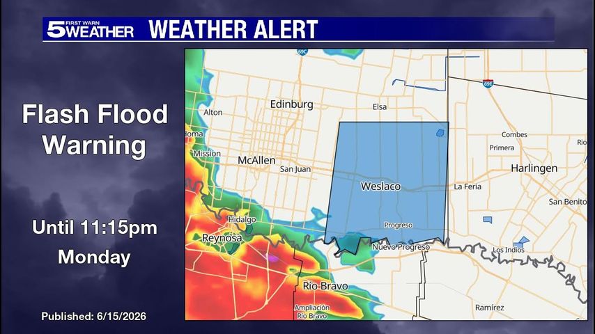
A flash flood warning is currently active in Hidalgo County until 11:15 p.m. on Monday. The National Weather Service has issued a Flood Watch for all of Deep South Texas, lasting until Thursday morning. Rainfall estimates range from 5 to 10 inches, with some areas potentially receiving over 12 inches due to heavy showers or thunderstorms. Residents are encouraged to stay updated by downloading the free KRGV FIRST WARN 5 Weather app or following the KRGV First Warn 5 Weather team on social media platforms like Facebook and X.
 Weather
Harlingen prepares for potential flooding
WESLACO, Texas (ValleyCentral) — William Valdez, a resident of Secluded Acres in Harlingen, is no stranger to flood waters. “When the rain came in in 2019, I already knew we were going to get hit," he said. "The canal broke off right here, right next to my house, and along the canal too, other areas.
WeatherHarlingen prepares for potential flooding
WESLACO, Texas (ValleyCentral) — William Valdez, a resident of Secluded Acres in Harlingen, is no stranger to flood waters. “When the rain came in in 2019, I already knew we were going to get hit," he said. "The canal broke off right here, right next to my house, and along the canal too, other areas.
 Weather
Up to 7,000 outages in Hidalgo Co., Magic Valley, AEP reports
HARLINGEN, Texas (ValleyCentral) — Multiple power outages have been reported in Hidalgo County following heavy rainfall and storms moving across the county, according to outage maps from American Electric Power Texas and Magic Valley Electric Cooperative. According to the ValleyStormTeam, rain totals will average 3-6″ for the Valley; however, slow-moving storms and repeated activity will likely
 Weather
Cameron County declares state of disaster over forecasted heavy rainfall
HARLINGEN, Texas (ValleyCentral) — Cameron County Judge Eddie Trevino Jr. has issued a Local State of Disaster for Cameron County due to the heavy rainfall and flooding. According to a news release from the Cameron County Judge, portions of Cameron County could receive between five and 10 inches of rain, with localized flooding reaching two to